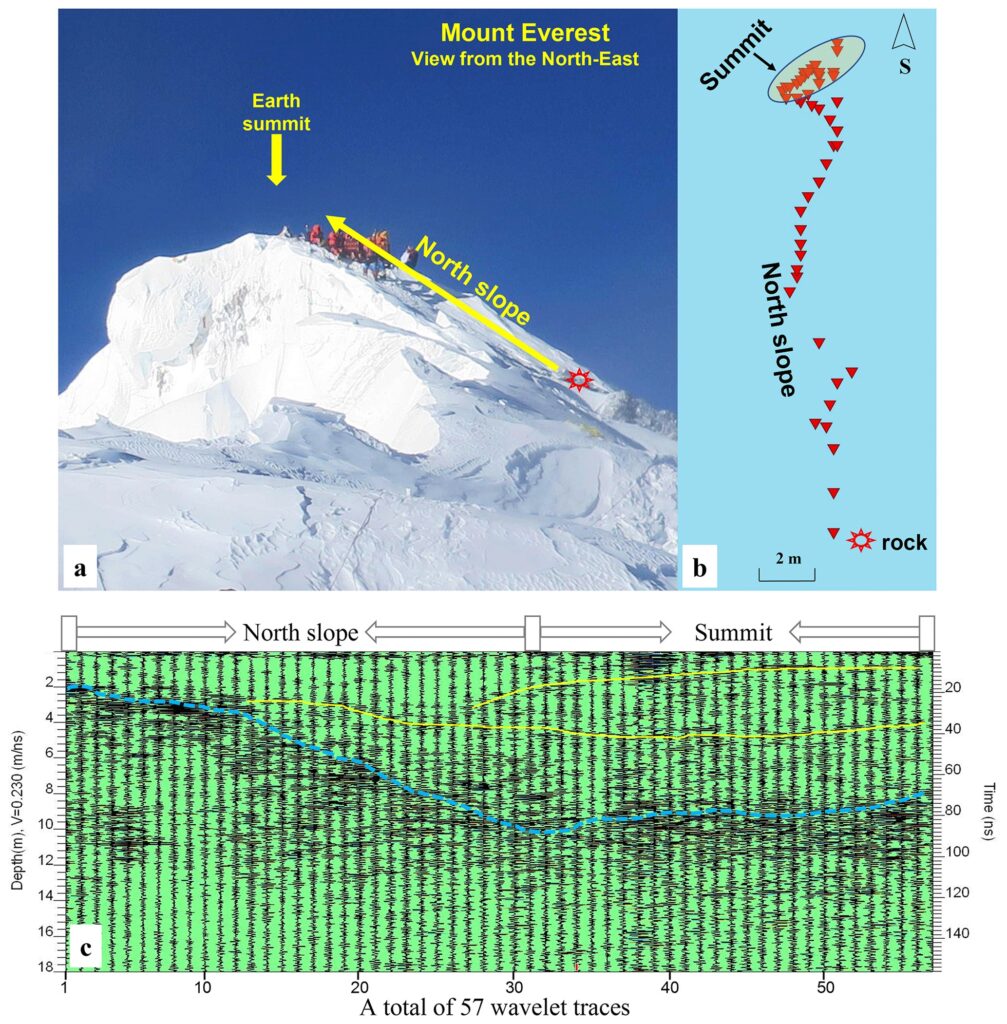
The second Qinghai-Xizang (Tibet) scientific research team used a radar profile measurement method to measure the latest snow depth on the top of Mount Everest as being 9.5±1.2 meters. This achievement was published as a highlight article in the international cryosphere journal The Cryosphere on Friday, providing valuable reference data for studying the dynamic changes of the cryosphere at extremely high altitudes and the lithosphere at the top of Mount Everest, the Global Times learned from the Chinese Academy of Sciences (CAS) on Saturday.
Yao Tandong, the leader of the team and the honorary director of the Institute of Tibetan Plateau Research (ITP), CAS, said that “this discovery not only reveals the depth of the snow on the summit of Mount Everest, but also contributes to a deeper understanding of climate change at extremely high altitudes, opening up new directions for the research,” according to a release provided by the CAS to the Global Times.
Mount Everest, one of the most inaccessible places on our planet, is considered to be the most iconic peak in the world. There are very strong scientific and public motivations for determining the snow depth on Mount Everest. Although China and Nepal jointly declared that the snow height of Mount Everest was 8848.86 meters above sea level in 2020, the true rock height has not been precisely determined due to the unknown snow depth below, read the paper based on the study which was published Friday.
Previously reported snow depths derived by different methods and instruments ranged from 0.92 to 3.5 meters on Mount Everest. In 1975, a Chinese expedition team reported an estimated snow depth of 0.92 meters by inserting a wooden stake into the snow. In 1992, a joint Chinese-Italian expedition team estimated a thickness of 2.52 meters by inserting a steel stake into the snow. In 2005, a Chinese mountaineering and surveying team claimed a snow depth of ∼3.5 meters by utilizing ground-penetrating radar. In 2019 and 2020, various Nepalese and Chinese expedition teams measured the snow depth using different radar instruments; however, no results were reported, according to the paper.
Supported by the Second Xizang Plateau Scientific Expedition and Research launched by the CAS, the team organized the Earth Summit Mission 2022 expedition during the period from April to May 2022. One of team’s key goals was to measure the snow depth on Mount Everest.
The team conducted the measurement with a single transmitter-receiver antenna at a frequency of 1,000 MHz and measured gradually from the exposed limestone to the summit.
Compared to previous measurement methods, this most recent attempt displays a well-defined gradual trend of radar reflection along the direction from the exposed limestone to the summit, which will help to correctly interpret the data, according to Yang Wei, who is in charge of the depth measurement project.
The results show that the depth of the snow on the top of Mount Everest is much higher than previously reported results. In May 2022, the thickness of the snow on the top of Mount Everest was estimated to be 9.5±1.2 meters.
(Global Times)


